Important Locations in England for Grimshaw Family History
The two most important locations for Grimshaw family history are in Lancashire, which is in the northwest part of England. The closest major city is Blackburn. The two locations are the Grimshaw site in Eccleshill Township, about 3 miles southeast of central Blackburn (near Darwen), and Clayton-le-Moors, which is about 6 northeast of central Blackburn. A regional map on a companion webpage shows other important surrounding locations.
Contents
Locations on Ordnance Survey Map
Grimshaw Location in Eccleshill
Webpage Credits
Appreciation is expressed to the British Ordnance Survey for making maps available online through its Get-a-Map feature on its website.
Locations on Ordnance Survey Map
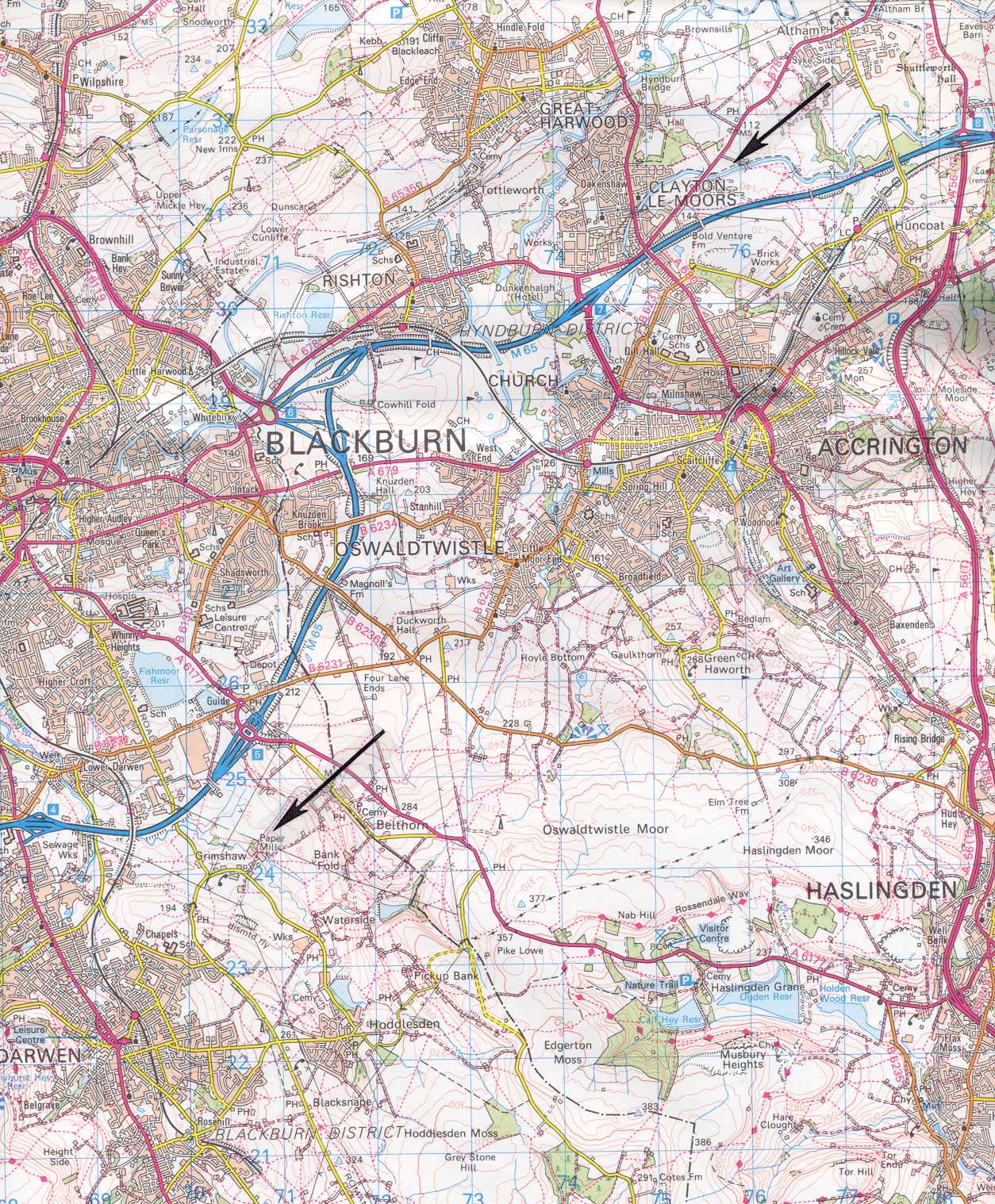
Both the Grimshaw and the Clayton-le-Moors locations are shown on the (British) Ordnance Survey map1 for the area (see Figure 1 below). The upper arrow on the map indicates Clayton-le-Moors, and the lower arrow shows the Grimshaw site.
Figure 1. Portion of the British Ordnance Survey map for the area around Blackburn. The lower arrow indicates the Grimshaw location south of Blackburn, and the upper arrow shows Clayton-le-Moors northeast of Blackburn. Note also the Dunkenhalgh Hotel to the southwest of Clayton-le-Moors. For scale, each blue square is one kilometer on a side.
The Grimshaw site is located on a stream called Hoddleston and then Waterside Brook in its upper reaches, Grimshaw Brook in the middle portion (where the Grimshaw site is), and Davyfield Brook in the lower reaches where it flows into the Darwen River. This stream also forms the boundary between two ancient, small townships – Eccleshill Township to the west and Yate and Pickup Bank Township to the east. Grimshaw is located on the west side of the stream just inside Eccleshill Township.
Apparently, the earliest recorded Grimshaw family lived at the Grimshaw location from its origins until the mid-1300s. The Grimshaw family relocated to Clayton Hall in Clayton-le-Moors because of a fortuitous marriage into the Clayton family. Clayton Hall can be seen as “Hall” just east of the “D” in “Great Harwood” in Figure 1.
Grimshaw Location in Eccleshill
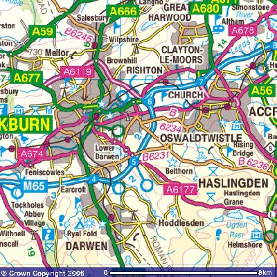
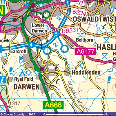
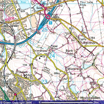
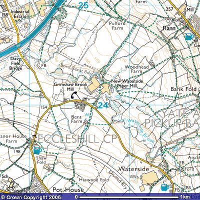
A series of maps of progressively larger scale is shown below for the Grimshaw location in Eccleshill (Figure 2). This series is from the Ordnance Survey’s “Get-a-Map” function on its website.
Figure 2. Progressively larger scale maps of Grimshaw Location in Eccleshill, southwest of Blackburn

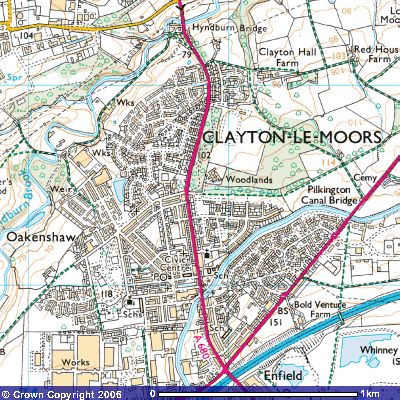
Clayton-le-Moors Location
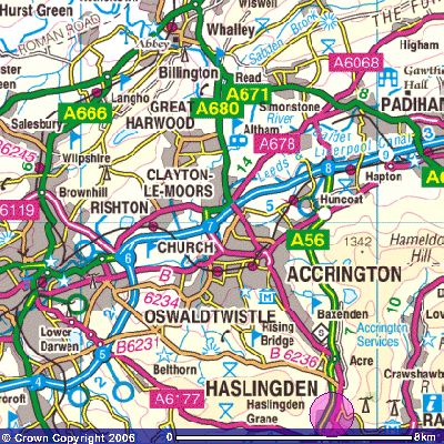
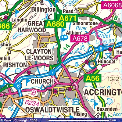
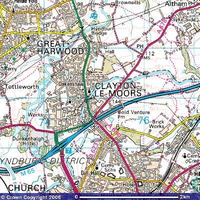
A similar series of maps of progressively larger scale is provided below for the Clayton-le-Moors location (Figure 3).
Figure 3. Series of maps showing location of Clayton-le-Moors northeast of Blackburn
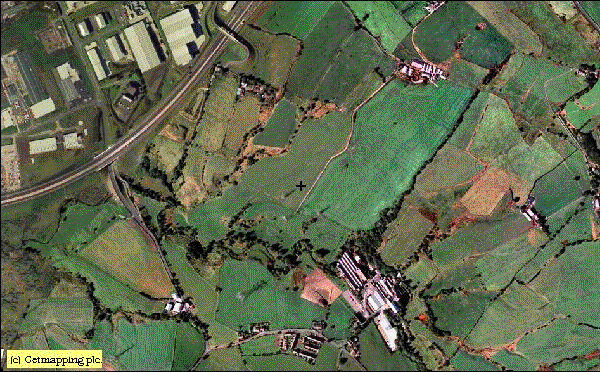
Aerial Photograph of the Grimshaw Site
An excellent color aerial photo of the factory at Grimshaw is shown in Figure 4. Belthorn is on the far right (east) side of the photo.
Figure 4. Aerial photo of Grimshaw location obtained from the Old Maps website (www.old-maps.co.uk). Grimshaw Brook can be seen running through the factory (from the bottom of the photo) and emerging on the west side, where it meanders to Davyfield Bridge for the M65.
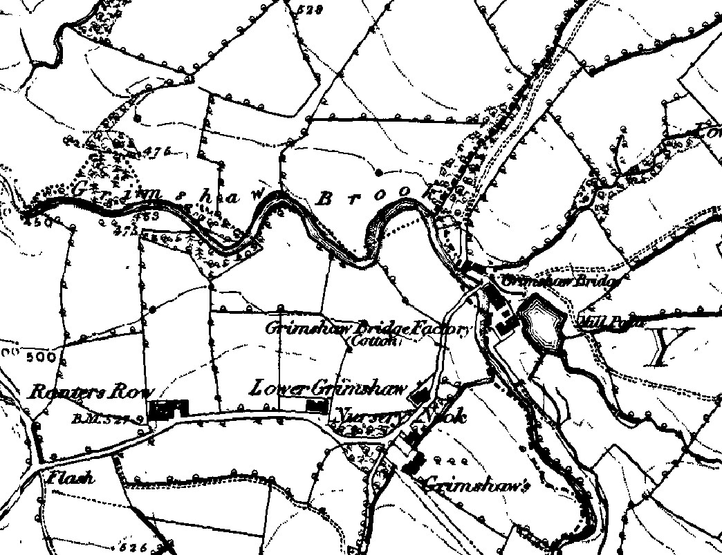
Eccleshill in 1846 and 1849
The area around Grimshaw as it existed over 150 years ago (about 1846) is shown on an Ordnance Survey map which is presented on a companion webpage. The Old Maps website (www.old-maps.co.uk) has available maps from 1849 for the area. A snippet for the Grimshaw location is shown in Figure 5.
Figure 5. 1849 Ordnance Survey map of the Grimshaw location and surrounding area. Note the significant features, including Grimshaw Brook, Grimshaw Bridge and Grimshaw Bridge Factory, Lower Grimshaw and “Grimshaw’s”. The Mill Pond to the southeast of the Grimshaw Bridge factory can still be seen in the air photo in Figure 4.
Reference
1British Ordnance Survey, 1998, Landranger Map Series, Sheet 103 (Blackburn and Burnley), scale 1:50 000, 1 sheet
Webpage History
Webpage posted July 2000, Updated October 2000. Updated March 2006 with additions of Ordnance Survey Get-A-Map maps for Grimshaw location in Eccleshill and for Clayton-le-Moors. Air photo and 1846/1849 maps also added.